eureka
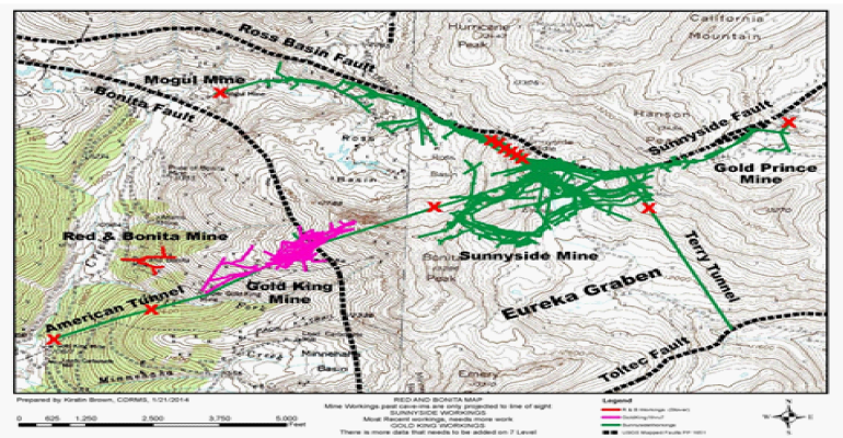
Figure 3: Map Showing the Surface Projection of Underground Mine Workings, Major Fault Zones and the Locations of Bulkheads (Red Xs) (modified from EPA, 2015a)

Figure 3: Map Showing the Surface Projection of Underground Mine Workings, Major Fault Zones and the Locations of Bulkheads (Red Xs) (modified from EPA, 2015a)
ARIZONA DAILY INDEPENDENT LLC © Contact Us: 20118 North 67th Avenue Suite 300 #239, Glendale, AZ, 85308 (520) 906-8081
Be the first to comment