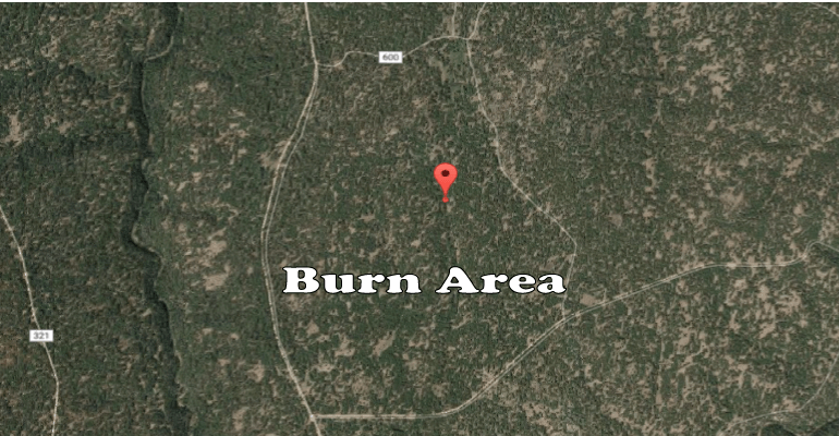
The Victorine prescribed burn project encompassing a total of approximately 2,000 acres starts today, fire managers expect 500 acres to be completed today north of Knoll Lake on the Coconino National Forest’s Mogollon Rim Ranger District.
This project is located 11 miles southeast of Clint’s Well and five miles north of Knoll Lake (34°29’7.76″N, 111° 7’5.19″W). The burn area will use Forest Roads 137, 600A, and local topography as boundaries today.
This project is located 11 miles southeast of Clint’s Well and five miles north of Knoll Lake (34°29’7.76″N, 111° 7’5.19″W). The burn area will use Forest Roads 137, 600A, and local topography as boundaries today.
Smoke is predicted to move toward the southwest which may impact local communities within the Blue Ridge area, state Route 87, Leonard Canyon, East Clear Creek, and may get as far as West Clear Creek and state Route 260. Cooling temperatures in the evenings may cause smoke to settle in the Happy Jack area and drain down nearby canyons.
Prescribed burns are always dependent upon approval from Arizona Department of Environmental Quality (ADEQ), weather and wind conditions, this burn could be canceled if conditions are not suitable.
The public can view approved prescribed burns on ADEQ’s website at smoke.azdeq.gov. Burns on the Coconino National Forest begins with the forest’s designator “COF.”
Notifications of upcoming prescribed burns are provided regularly by news releases throughout the season and also by the following online resources:
- Sign up to receive news releases from Coconino NF: www.fs.fed.us/news/subscription.shtml
- Coconino NF’s Inciweb page: http://inciweb.nwcg.gov/unit/303/ (under Fall 2017 prescribed burns)
- Coconino NF’s Twitter account: www.twitter.com/CoconinoNF
- Coconino NF public website: www.coconinonationalforest.us (Under News and Events)
- Coconino NF’s Facebook page: www.facebook.com/coconinonf
